|
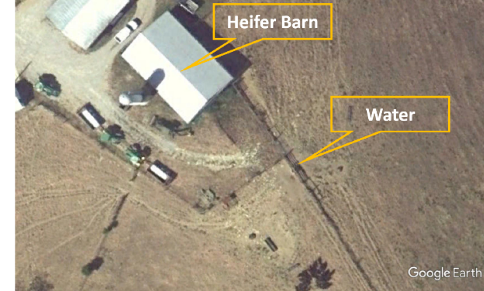
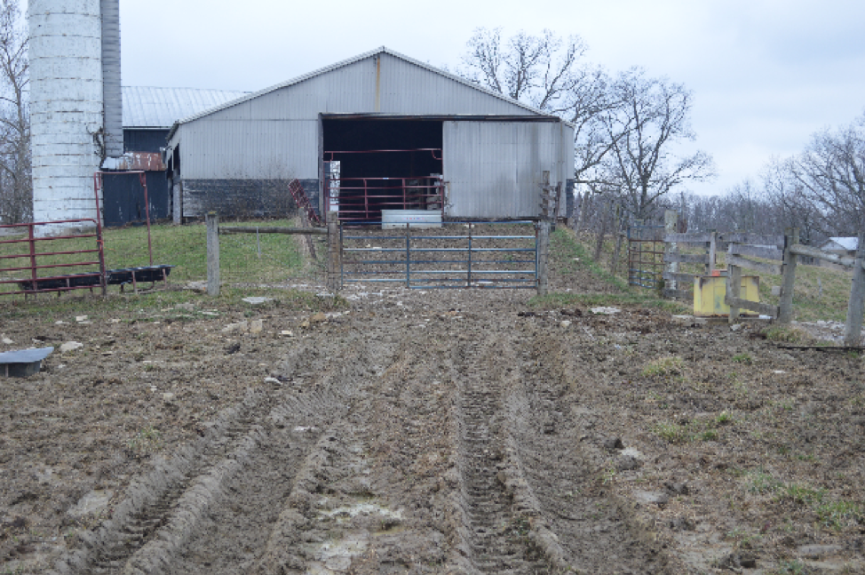
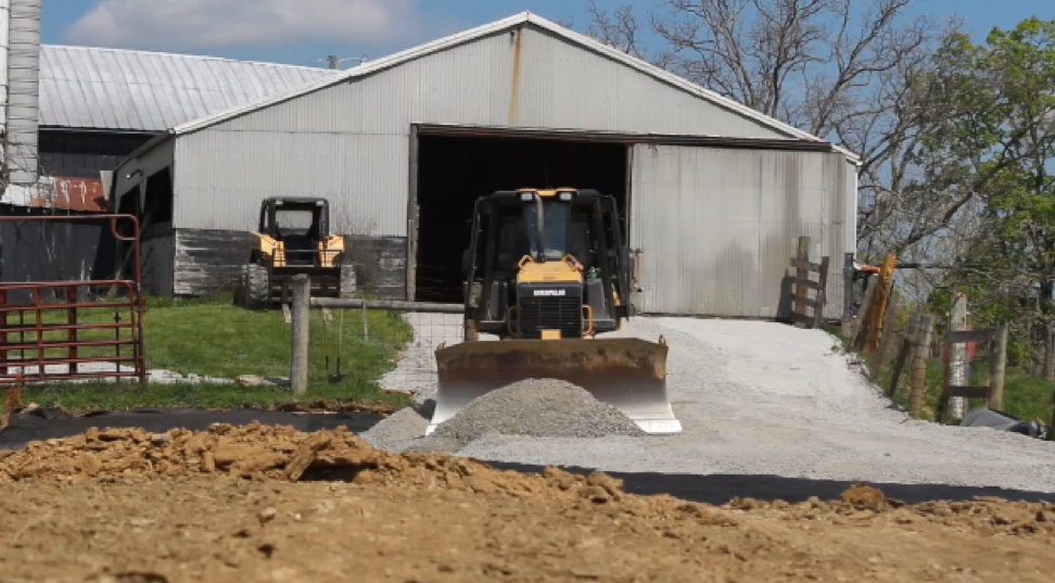
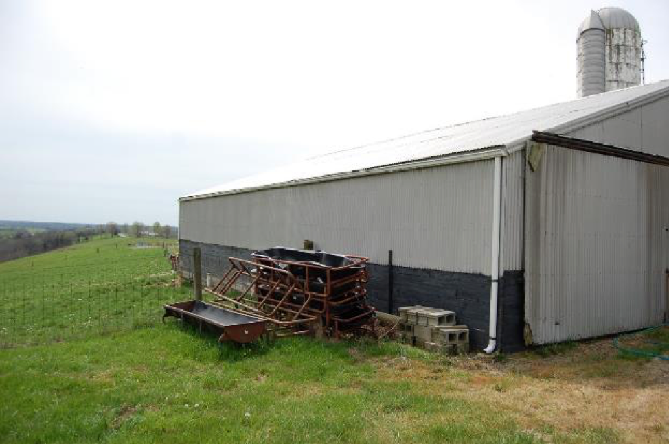
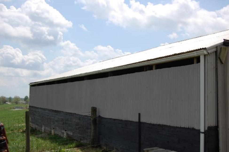
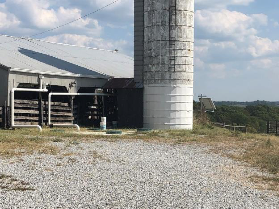
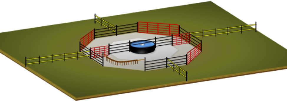
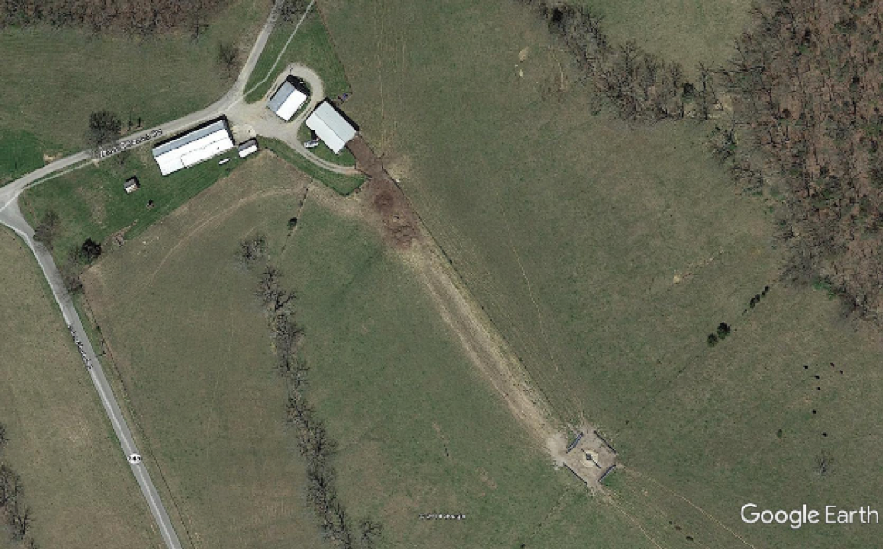
Dr. Steve Higgins, University of Kentucky A typical cow-calf grazing operation needs to feed and water cattle on a daily basis. Ideally, this is accomplished by rotating cattle from field to field and providing them with a convenient source of water to drink. Cattle operations can better manage cattle when facilities are designed to meet the needs of cattle and the producer. Land use-planning can increase production and reduce production costs. Land and water use planning is a systems approach to solving production problems through developing or improving an agricultural operation. This process questions the technological validity and biological necessity of every feature of an operation or area of interest. The process systematically addresses the problems located within a defined area, the way the problems could be solved, the plan for solving the problem, and weighs the options to develop economical and optimal resource use. The objectives of land and water use planning are to increase production and reduce production costs. This is accomplished by critically evaluating the type, scale, timing, sequence, nature, and purpose of every element of every process. The ultimate goal is to bring all of the farm’s resources (soil, water, air, machinery, shape and condition of all field and structures, livestock, and labor) into a condition of better balance or harmony. To be successful, this approach should improve water, soil and air qualities, and thereby improve animal performance. It accomplishes this by evaluating space that includes access, location, shape and dimensions of watering stations, building layout, barn function, structures, pastures, feeding structures, and lanes/alleyways/roadways to improve efficiency for the producer. A demonstration of land and water use planning is this example from a working farm. The Eden Shale Farm, in Owen County KY, has an old structure that was once used as the sheep barn. (Fig. 1). An abandoned silo bisects the open, southwestern side of the structure. Animals get into the structure by ascending a slope at its southern end. Several pastures and a city-fed water fountain (Figs. 1 and 2) are adjacent to the structure. Many pastures are in a rotational grazing schedule, which incorporates these four pastures. The structure is used to house feed or provide shade to groups of cattle during the rotation, depending on the group and the time of the year. This rotational schedule has the cattle grazing the pastures for ten days and leaving the area for about 30 days to allow the pastures to recover. Land and water use planning for this farm had specific objectives: to improve cattle surfaces; the space provided for them to move, eat, and drink; the air they breathe; and the means by which they were confined. Creating plans, maps, sketches, and calculations cost very little to do and guided the planning group’s decisions. Mapping tools such as Google Earth, Google Earth Pro, Arc Map, etc. were very useful for creating maps and measuring distances. The planning process also clarified options for solving problems. An economic analysis of the materials needed to implement a plan could be determined from the plan. A cost-benefit analysis could also be conducted to justify the expense of the project. To improve surfaces for cattle traffic, a heavy-use area was created using geotextile fabric and rock starting at the gateway of the main pasture, up the ramp, and into the structure. This was created to provide an all-weather surface to improve the surfaces, control mud, and provide drainage (Fig. 3). To improve air quality, the top section of the northeast wall was removed (Figs. 4 and 5). Opening this area under the eave allowed prevailing winds to pass through the narrow side of the structure. The air movement helps keep the barn air fresh, while moving moisture and contaminants out of the structure. Dry manure creates less odor and attracts fewer flies than wet manure. Drinking water was improved by creating a water-harvesting system with improved access to a watering station. Rainfall harvested from the roof provides the drinking water for stock, when they are in this area. The 40 by 60 structure captures approximately 1,500 gallons of rainwater with each inch of rainfall. To create the system, the downspouts from the southwest were routed into two - 2,000 gallon cisterns, which were placed on the southwest side of the structure. The downspouts from the northeast side were routed through the structure to also drain into these cisterns (Fig. 6). Water captured in the cisterns is pumped into the silo, which was sealed with hydraulic cement to store water. The total volume of the system is approximately 6,000 gallons. This volume matches the requirements for 30 cow-calf pairs, or approximately 5,300 gallons, with a buffer of 700 gallons. Assuming Kentucky averages four inches of precipitation per month, the system has time to recharge while the cattle are rotated to another pasture for 30 days. The water pump and controller were purchased as a unit. A 12-volt solar panel and pump controller powers the system from the cisterns to the silo. A series of float switches turns the pump on and off automatically, as needed, to keep the silo filled and empty the cisterns. Once in the silo, the water can be distributed to the waterer using head pressure or gravity and controlled by the float valve in the tire waterer. The water supply to the tire waterer is a hybrid system. In winter, the system is drained and the water supply is switched to city water. The size of the pastures at this site allowed 31 cow-calf pairs to graze for 10 days. The water requirement for the cattle was estimated to be 17 gallons per cow-calf pair. The total requirement, for the 10 days, was estimated to be 5,270 gallons, whereas the water harvesting system provided approximately 5,538. One method to justify the expense of the water harvesting system is to consider water not being available. The grazing plan for this farm utilized this paddock system approximately six times per year. Thirty-one cows grazing for ten days, six times per year would equal 1,860 grazing days per year. In the absence of water, cattle would have to be fed with harvested and conserved forages costing approximately $2.00 per day. The economic benefit of the water harvesting system for a year would be approximately $3,720. Land and water use planning considers spatial parameters that include access, location, shape and dimensions. Figure 7 shows a diagram of the watering station that was installed on the Eden Shale Farm. Drinking water is piped to a circular tire waterer at the intersection of four fields. The location is a summit position that allows cattle to stand flat when drinking, which is what they prefer. Installing the circular waterer using a recycled tire in a fence-line increases efficiency by creating a hub. A concrete pad was installed around the tire to provide firm, flat footing for the animals. A geotextile fabric and rock heavy use area was created on the remaining surface of the hub and into the gateways. Opening the cross gates allows the producer to use the entire area to water a herd; gates can be closed so the waterer serves two separate cattle groups simultaneously. Having four gates from the hub lead into four different pastures facilitates rotational grazing. Viewed from the pasture side, the gates going into the hub are located in the corner of each pasture, which facilitates cattle transfer and circulation. The proximity of the hub gates allows a producer to move cattle from any field to any of the three other fields with a maximum travel distance of approximately 45 feet. Relocating the water source from its original location to further into the field reduced the one-way cattle travel distance by 500 feet and created a centralized location between the four pastures. Installing the tire at a height equal to or less than 22-inches lets calves drink. This will allow them to get on forage sooner and increase gains compared to calves on milk alone. In addition to providing water, this centralized, hub design can be used for mineral, concentrate diets in portable bunkers, and as a catch pen. An insecticide rope can be placed across the gateway to provide control of face flies. The greatest advantage of this structure is that it performs its main function of providing water, while improving and simplifying the cattle management. Figure 8 is a current aerial view of the project area. Comparing this image with the images in Figs. 1 and 2, respectively, demonstrates the repositioned waterer in relation to the heifer barn and rotating pastures. Summary A typical cow-calf operation needs to feed and water cattle on a daily basis. This is accomplished by rotating cattle from field to field and providing them with a convenient water source. Cattle operations can manage cattle better when facilities are designed to meet the needs of cattle and the producer. At Eden Shale, an existing structure, a used construction tire, and surrounding pastures were used to reduce capital costs and create an automated system. This system implemented as part of this case study used free energy in the form of prevailing winds, gravity, solar energy, and precipitation. Installing a watering station that served four pastures allowed the producer to easily move cattle from field to field and saved time. In this way, land use-planning can increase production and reduce production costs. Shape, dimension, location, and access play a crucial role in land and water use planning. A large circular waterer split between two pastures provided space for animals to drink. The harvested water source was automatic, except for seasonal maintenance. Soil, water, and air conditions were improved for animal health. Mud around the waterer, ramp, gateways, and structure was reduced by creating heavy-use areas for cattle to eat, drink, and lie on. Ventilation was improved in the structure to increase clean air and reduce odor. Approaching cattle management from a land and water-use planning perspective encourages producers to build a productive environment for cattle, which promotes good animal health, rapid growth, and efficient feed use. The planning part of the land and water use process requires maps and documentation. Google Earth images and cost benefit analysis are some of the tools that can be used in the planning process. Once a system is installed, it should reduce production costs while optimizing cattle performance, which improves farm profits and function. Comments are closed.
|
Archives
June 2024
Categories
All
Welcome |
CONTACT US |
EMAIL SIGN UP |
|
Eden Shale Farm
245 Eden Shale Rd. Office: (859) 278-0899 Owenton, KY 40359 Fax: (859) 260-2060 © 2021 Kentucky Beef Network, LLC.. All rights reserved.
|
Receive our blog updates
|

 RSS Feed
